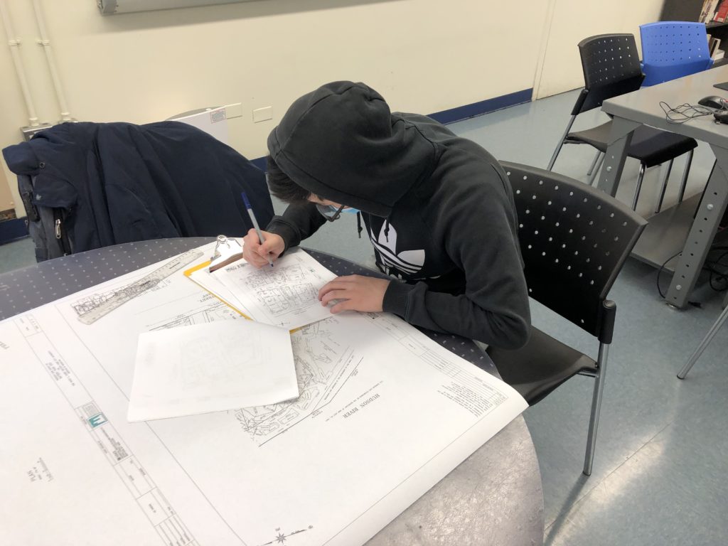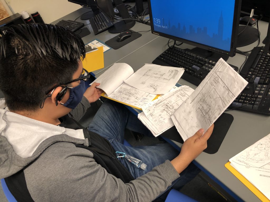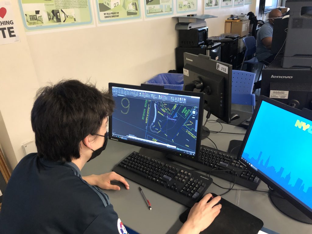
Battery Park City is situated on the southwest part Manhattan Island. This 25-acre park in Battery Park City, as well as the entire community, has been managed by Battery Park City Authority since 1968, transforming the area from a feeble state to today’s thriving community. A problem has recently arisen regarding the current map of Battery Park City: the issue revolving around its relative lack of detail. Battery Park City Authority, as expected, acquired the job of editing and improving the map. This is where the Battery Park City project started. Permit Associate John Sherzai, a WHSAD alumnus, contacted WHSAD in hopes of developing a partnership for students to assemble the drawings as a work project. Through the completion of this project, Battery Park City will be able to acquire sufficient floor plans that can aid in the permit application process as well as improve the quality of life for residents in the surrounding area during events. As part of this project, the students are tasked with designing layouts of the areas that their measurements indicate.
To gain both a student and stakeholder perspective, a few questions were posed to those involved in the project.
John Sherzai, WHSAD Almnus, Battery Park City Authority Permit Associate
Why do you feel confident in bringing such a project to WHSAD students?
When I was first tasked with finding a way to develop new layouts of our space, I remember looking at what we had on file and thinking to myself, “This is ridiculous. Give me a tape measure, clipboard, and a license for AutoCAD, I can make this better myself.” But I quickly realized I would take me forever to do. That thought lead me realize, that the same place that gave me the skills to believe I could do it myself, is still teaching kids those same skills right now! Mr. Codio never missed an opportunity to remind my class how lucky we were to be in such a unique curriculum. Quite frankly, there is no other public school in New York City that teaches the skills necessary to get a project like this done.
After the Battery Park City project is completed, how might the project’s resulting product develop and be reconditioned over time?
Battery Park City Authority leadership is currently working on a huge ‘Resilience Action Plan.’ Part of this plan will involve tearing down and completely renovating the park space on the waterfront. The space is being redesigned in such a way to protect lower Manhattan from a natural disaster, like the one we experienced during Super Storm Sandy. So eventually, we need to update the layouts WHSAD students will make. The park space will also subtly change and develop over time. Art installations will come and go. Walkways and the park lawns could change. Battery Park City never stops evolving!
Do you have any other thoughts to share regarding your experience working with WHSAD?
Ms. Wilson and Mr. Codio have been a joy to work with. They are always responsive to my emails and calls. They will always answer our questions and concerns. I really was not expecting my career to lead to working with my high school teachers, but I’m so glad it has!
On March 22nd, 2021, John Sherzai hosted a meeting with WHSAD students to introduce them to the Battery Park Project. To view meeting, click here:
Ryan Singh, WHSAD Senior
I found this project with Battery Park City to be extremely eventful and engaging. I have only been participating in this project for two weeks; however, through this short time, I have found much interest in the site and project. I believe that I gained such a strong interest in this project due to the fact that it is one of my first projects where I get to exam a site. This is extremely important to me because I am a visual learner, so by accessing the site on Google Maps, I am able to stay more connected and focused on the work that needs to be done. In week 1 we investigated the site to scope out the area and create a plan on how we will complete this project. In week 2 we started working by taking over our designated sites and measuring all the structures on them. Overall, I find these two weeks of working for Battery Park City to be extremely effective, eventful, and engaging.
Some of the key factors have to be the students and worksite supervisors (Mr.Codio, Mr.Rodriguez, and Mr.Koestner). I believe that they are the key factors along with the students because we all work as one big team on the site. Although we are separated and designated for specific sites, we all work together to help each other out to ensure we do our jobs correctly and efficiently. Furthermore, there is a lot of consulting between the project managers and the supervisors as they continuously discuss what is the best way to compete and start the measurements for the sites.
Yu Feng Zhou, WHSAD Senior
Even though this project has just recently begun, I believe the progress is great, and could’ve been better if we could go physically. Students were able to go through Battery Park on Google Maps and Google Earth. The first virtual site visit’s intended purpose was to get the students to get used to the environment and actually see what’s going on. On the second virtual site visit, which is the most recent site visit, students noticed huge inconsistencies between the original floor plans and what is actually going on in Battery Park City. Such as the flower beds’ location is inaccurate and items like benches were not recorded.
I have encountered substantial difficulty on the most recent site visit. Some parts of the rendering of Google Maps and Google Earth are badly made, so those areas will become obstacles when the floor plan revision starts. Luckily we were able to find tour guide videos of Battery Park City, we were able to see and understand the actual areas that were rendered terribly.
Some key factors that have been contributing to the project’s development thus far are AutoCAD and Discord. Students were able to start making changes on AutoCAD and communicate with others through Discord. On this platform, users communicate with voice calls, video calls, text messaging, media and files in private chats or as part of communities called “servers”.
Marc Joseph, WHSAD Sophomore
Working on this project has been really educational and fun, we get real-life experience on this type of work and we get paid for it. At first, we visited the site using Google Maps and Google Earth and looked at the different parts of Battery Park City sort of like a tour. On the second investigation, we began taking measurements to update the blueprint of the park. Everything has been pretty much good, and now we’re putting the measurements in Cad and as we measure more parts of the park the more information we can put in Cad.

Marlon Corrales, WHSAD Senior
When I was first introduced to this project, I got excited to be working for it since this is a paid internship. But due to the COVID-19 Pandemic, me and the other students who are part of this as well couldn’t visit the site. We were given the AutoCAD site plan of the Battery Park City, where we were supposed to see exactly how Battery Park City looked and what we needed to do. So students like me used Google Maps to first see Battery Park City like if we were visiting the site. Thanks to the technology that we have, Google Maps helps us view each section of the site we had to see, looking through the differences of the site plan and the site, and figuring out what pieces are missing from the site that need to be put on the site plan.
I did encounter some difficulties while working on this project. One of them was my heavy schedule from working on the site to focusing on my classes. Since this is my senior year, I had to focus a lot on my classes for graduation requirements, which kept me for so much time in doing work than working on this. Especially during remote learning where internet connections can lag a lot; and some students don’t even have AutoCAD at home in which I couldn’t even work well with them online. But now that I and most other students are back to school in-person, we have better computers to work properly on AutoCAD drawing and viewing the site more efficiently.
Some key factors that have been contributing to the project’s development thus far are using the internet for viewing the Battery Park City site online with 3D viewing and close distance. Another one is using AutoCAD at home and at school where now we can add or update the site plan with what we found and what we needed to adjust in order to complete the Battery Park City Project.
Ethan Ikegami, WHSAD Senior
Currently we have had a few sessions working with the Battery Park City data. Our first session was a review of the entire site where we sectioned off the park and assigned specific sections to our groups. We then analyzed all objects that were required to be mapped out in the park. During our second session we divided into groups and began mapping the site sections. Using Google Earth, my group started from the corner of a building and began measuring planter to planter.
Our biggest difficulty was communicating with the other groups. Despite organizing the park into manageable sections, we had difficulty revising the work of the other groups. There were little to no measurements labeled in their original CAD sketches, so it was difficult to accurately confirm the validity of the measurements each group had, but with the next session our information problems will be sorted as we can simply measure each other’s work.


